
东溪镇 topographic map
Interactive map
Click on the map to display elevation.
About this map
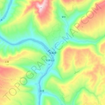
Name: 东溪镇 topographic map, elevation, terrain.
Location: 东溪镇, 苍溪县, 广元市, 四川省, 中国 (32.02553 106.20826 32.10553 106.28826)
Average elevation: 2,349 ft
Minimum elevation: 1,335 ft
Maximum elevation: 3,973 ft
Other topographic maps
Click on a map to view its topography, its elevation and its terrain.