Geolocate

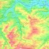
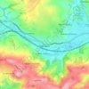
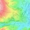
Slaithwaite topographic map

Click on the map to display elevation.

Slaithwaite

In the 1848 edition of 'A Topographical Dictionary of England', Samuel Lewis (the editor) wrote:- "the lands are in meadow and pasture, with a small portion of arable; the scenery is bold and romantic. In the quarries of the district are found vegetable fossils, especially firs and other mountain trees. The village is beautifully seated in the valley of the river Colne; the inhabitants are chiefly employed in the woollen manufacture, in the spinning of cotton and silk, and in silk-weaving"

Wikipedia (CC-BY-SA 3.0)

About this map

Name: Slaithwaite topographic map, elevation, terrain.

Location: Slaithwaite, Kirklees, West Yorkshire, England, HD7 5AG, United Kingdom (53.60358 -1.89938 53.64358 -1.85938)

Average elevation: 791 ft

Minimum elevation: 351 ft

Maximum elevation: 1,283 ft

Other topographic maps

Click on a map to view its topography, its elevation and its terrain.
Meltham

United Kingdom > England > Kirklees

Average elevation: 912 ft

Kirkburton

United Kingdom > England > Kirklees

Average elevation: 486 ft

Wessenden Head Reservoir

United Kingdom > England > Kirklees

Average elevation: 1,417 ft

Holmfirth Branch

United Kingdom > England > Kirklees > Brockholes

Average elevation: 607 ft

Mirfield

United Kingdom > England > Kirklees > Lower Hopton

Average elevation: 318 ft

Denby Dale

United Kingdom > England > Kirklees > Scissett

Average elevation: 551 ft

Holme Valley

United Kingdom > England > Kirklees > Holmfirth

Average elevation: 951 ft

Greenhead Park

United Kingdom > England > Kirklees > Huddersfield

Average elevation: 390 ft

Hey Wood

United Kingdom > England > Kirklees > Farnley Tyas

Average elevation: 610 ft

Crow Nest Park

United Kingdom > England > Kirklees > Dewsbury

Average elevation: 210 ft

Denby Dale

United Kingdom > England > Kirklees

Average elevation: 614 ft

Gear up for your next adventure:

📚Navigation Handbooks - Master the art of reading topographic maps and using a compass
📌Outdoor GPS Map App - Apps and devices for digital topographic navigation
🧦Hiking Socks - Comfortable socks to prevent blisters on long hikes
🪶Paracord Bracelet - Survival bracelet with built‑in tools
🪵Folding Camp Saw - Compact saw for wood and campsite work

As an Amazon Associate, this site earns from qualifying purchases at no extra cost to you.