
Thank you for supporting this site ❤️
Make a donation
Make a donation
Gear up for your next adventure:
As an Amazon Associate, this site earns from qualifying purchases at no extra cost to you.
Emmanuel topographic map
Click on the map to display elevation.
Thank you for supporting this site ❤️
Make a donation
Make a donation
Gear up for your next adventure:
As an Amazon Associate, this site earns from qualifying purchases at no extra cost to you.
About this map
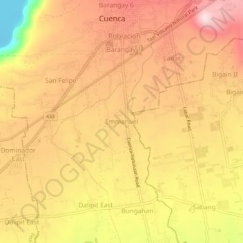
Name: Emmanuel topographic map, elevation, terrain.
Location: Emmanuel, Cuenca, Batangas, Calabarzon, 4222, Philippines (13.86453 121.03087 13.90453 121.07087)
Average elevation: 804 ft
Minimum elevation: -10 ft
Maximum elevation: 1,273 ft
Thank you for supporting this site ❤️
Make a donation
Make a donation
Gear up for your next adventure:
As an Amazon Associate, this site earns from qualifying purchases at no extra cost to you.