
Thank you for supporting this site ❤️
Make a donation
Make a donation
Gear up for your next adventure:
As an Amazon Associate, this site earns from qualifying purchases at no extra cost to you.
Angamoozhy topographic map
Click on the map to display elevation.
Thank you for supporting this site ❤️
Make a donation
Make a donation
Gear up for your next adventure:
As an Amazon Associate, this site earns from qualifying purchases at no extra cost to you.
About this map
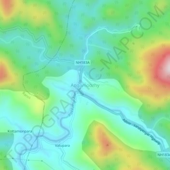
Name: Angamoozhy topographic map, elevation, terrain.
Location: Angamoozhy, Konni, Pathanamthitta, Kerala, 689667, India (9.34078 76.96881 9.38078 77.00881)
Average elevation: 764 ft
Minimum elevation: 249 ft
Maximum elevation: 2,119 ft
Thank you for supporting this site ❤️
Make a donation
Make a donation
Gear up for your next adventure:
As an Amazon Associate, this site earns from qualifying purchases at no extra cost to you.