
Thank you for supporting this site ❤️
Make a donation
Make a donation
Gear up for your next adventure:
As an Amazon Associate, this site earns from qualifying purchases at no extra cost to you.
Harbha topographic map
Click on the map to display elevation.
Thank you for supporting this site ❤️
Make a donation
Make a donation
Gear up for your next adventure:
As an Amazon Associate, this site earns from qualifying purchases at no extra cost to you.
About this map
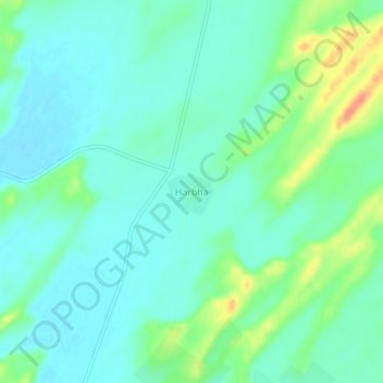
Name: Harbha topographic map, elevation, terrain.
Location: Harbha, Fatehgarh Tehsil, Jaisalmer, Rajasthan, India (26.33845 71.00925 26.37845 71.04925)
Average elevation: 814 ft
Minimum elevation: 774 ft
Maximum elevation: 915 ft
Thank you for supporting this site ❤️
Make a donation
Make a donation
Gear up for your next adventure:
As an Amazon Associate, this site earns from qualifying purchases at no extra cost to you.