Geolocate

Rolling Acres topographic map

Click on the map to display elevation.

About this map
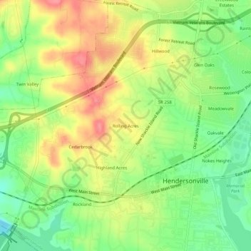
Name: Rolling Acres topographic map, elevation, terrain.

Location: Rolling Acres, Hendersonville, Sumner County, Tennessee, 37075, United States (36.29366 -86.65333 36.33366 -86.61333)

Average elevation: 515 ft

Minimum elevation: 387 ft

Maximum elevation: 650 ft

Tennessee trails, hiking, mountain biking, running and outdoor activities

Gear up for your next adventure:

🔭Compact Binoculars - HD vision for scouting terrain and identifying distant landmarks
🥘Titanium Cookware - Durable, featherlight pots and pans for backpacking
🎒Trail Energy Bars - High‑calorie bars for hiking energy
📻Weather Alert Radios - Stay informed of storm risks while off-the-grid
🧼Biodegradable Camping Soap - Eco‑friendly soap for outdoor hygiene

As an Amazon Associate, this site earns from qualifying purchases at no extra cost to you.