Geolocate

Minneapolis topographic map

Click on the map to display elevation.

About this map

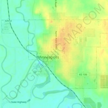
Name: Minneapolis topographic map, elevation, terrain.

Location: Minneapolis, Ottawa County, Kansas, United States (39.11408 -97.72460 39.13227 -97.68788)

Average elevation: 1,280 ft

Minimum elevation: 1,234 ft

Maximum elevation: 1,335 ft

Ottawa County trails, hiking, mountain biking, running and outdoor activities

Gear up for your next adventure:

🧴Hand Sanitizer - Keep hands clean while hiking
🎒Gear Packing Cubes - Organize your backpack efficiently
🛶Inflatable Kayak - Portable kayak for rivers, lakes, and expeditions
💧Water Purification System - Clean water on the trail with reliable purifiers
🗺️NatGeo Topo Maps - High-quality waterproof printed topographic maps of US Parks

As an Amazon Associate, this site earns from qualifying purchases at no extra cost to you.