Geolocate

Stopham topographic map

Click on the map to display elevation.

About this map

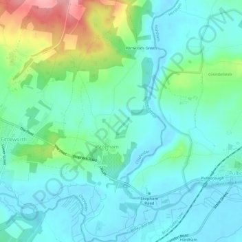
Name: Stopham topographic map, elevation, terrain.

Location: Stopham, Chichester, West Sussex, England, United Kingdom (50.94803 -0.55061 50.98141 -0.52668)

Average elevation: 95 ft

Minimum elevation: -10 ft

Maximum elevation: 394 ft

Gear up for your next adventure:

🩳Quick‑Dry Hiking Shorts - Comfortable and quick‑dry shorts for summer hiking
🔭Stargazing Telescopes - Perfect for camping in low-light pollution areas shown on maps
Backpacking Tent - Lightweight and durable tent for multi‑day hikes
🗃️Trail First Aid Kit - Essential kit for outdoor injuries and emergencies
🧦Hiking Socks - Comfortable socks to prevent blisters on long hikes

As an Amazon Associate, this site earns from qualifying purchases at no extra cost to you.