

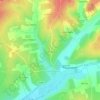
Chez Jonchère topographic map
Click on the map to display elevation.
About this map

Name: Chez Jonchère topographic map, elevation, terrain.
Average elevation: 256 ft
Minimum elevation: 138 ft
Maximum elevation: 420 ft
Other topographic maps
Click on a map to view its topography, its elevation and its terrain.

Lignières-Sonneville
France > Nouvelle-Aquitaine > Charente > Lignières-Ambleville
La commune a un relief assez vallonné, typique de la Champagne. Deux vallées de direction est-ouest traversent la commune, celle de Sonneville au nord et celle de Lignières au sud. Le point culminant de la commune est à une altitude de 143 m, situé à l'extrémité nord-est au Canton Marceau. Le Puy du…
Average elevation: 276 ft

Maison de Lin
France > Nouvelle-Aquitaine > Charente > Lignières-Ambleville > Les Hauts-Bonnaud
Average elevation: 240 ft
Ambleville
France > Nouvelle-Aquitaine > Charente > Lignières-Ambleville
Le territoire communal a un relief assez vallonné et s'élève progressivement pour atteindre, à son extrémité nord, près du hameau de la Voûte, la cote de 95 m. La petite vallée du Collinaud occupe le sud de la commune où sont situés le bourg et la route principale. Le point le plus bas est à 34 m,…
Average elevation: 207 ft