
Ghoy topographic map
Interactive map
Click on the map to display elevation.
About this map
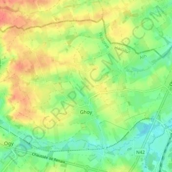
Name: Ghoy topographic map, elevation, terrain.
Location: Ghoy, Lessines, Ath, Hainaut, Wallonie, 7863, Belgique (50.71841 3.77333 50.75071 3.83836)
Average elevation: 125 ft
Minimum elevation: 46 ft
Maximum elevation: 210 ft
Other topographic maps
Click on a map to view its topography, its elevation and its terrain.