
Thank you for supporting this site ❤️
Make a donation
Make a donation
Gear up for your next adventure:
As an Amazon Associate, this site earns from qualifying purchases at no extra cost to you.
Guabalcon topographic map
Click on the map to display elevation.
Thank you for supporting this site ❤️
Make a donation
Make a donation
Gear up for your next adventure:
As an Amazon Associate, this site earns from qualifying purchases at no extra cost to you.
About this map
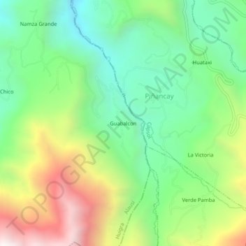
Name: Guabalcon topographic map, elevation, terrain.
Location: Guabalcon, Huigra, Alausí, Chimborazo, 060205, Ecuador (-2.32573 -78.97456 -2.28573 -78.93456)
Average elevation: 6,617 ft
Minimum elevation: 4,895 ft
Maximum elevation: 9,590 ft
Thank you for supporting this site ❤️
Make a donation
Make a donation
Gear up for your next adventure:
As an Amazon Associate, this site earns from qualifying purchases at no extra cost to you.