
Thank you for supporting this site ❤️
Make a donation
Make a donation
Gear up for your next adventure:
As an Amazon Associate, this site earns from qualifying purchases at no extra cost to you.
Machangara topographic map
Click on the map to display elevation.
Thank you for supporting this site ❤️
Make a donation
Make a donation
Gear up for your next adventure:
As an Amazon Associate, this site earns from qualifying purchases at no extra cost to you.
About this map
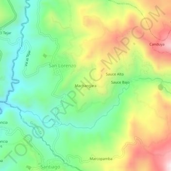
Name: Machangara topographic map, elevation, terrain.
Location: Machangara, San Lorenzo, Guaranda, Bolívar, 020302, Ecuador (-1.70090 -79.01154 -1.66090 -78.97154)
Average elevation: 8,566 ft
Minimum elevation: 7,713 ft
Maximum elevation: 9,856 ft
Thank you for supporting this site ❤️
Make a donation
Make a donation
Gear up for your next adventure:
As an Amazon Associate, this site earns from qualifying purchases at no extra cost to you.