
Salang topographic map
Interactive map
Click on the map to display elevation.
About this map
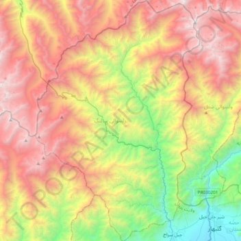
Name: Salang topographic map, elevation, terrain.
Location: Salang, Parwan Province, Afghanistan (35.11262 69.01680 35.42101 69.27534)
Average elevation: 10,115 ft
Minimum elevation: 5,056 ft
Maximum elevation: 15,699 ft
Other topographic maps
Click on a map to view its topography, its elevation and its terrain.
Bagram
Afghanistan > Parwan Province > Bagram
Bagram, Parwan Province, Afghanistan
Average elevation: 4,895 ft
Chaharikar
Chaharikar, Parwan Province, Afghanistan
Average elevation: 6,286 ft