
Chaharikar topographic map
Interactive map
Click on the map to display elevation.
About this map
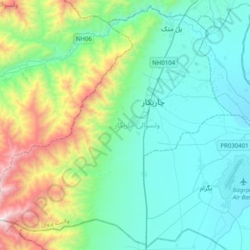
Name: Chaharikar topographic map, elevation, terrain.
Location: Chaharikar, Parwan Province, Afghanistan (34.88014 68.97984 35.10194 69.26325)
Average elevation: 6,286 ft
Minimum elevation: 4,747 ft
Maximum elevation: 11,939 ft
Other topographic maps
Click on a map to view its topography, its elevation and its terrain.
Bagram
Afghanistan > Parwan Province > Bagram
Bagram, Parwan Province, Afghanistan
Average elevation: 4,895 ft