
Thank you for supporting this site ❤️
Make a donation
Make a donation
Gear up for your next adventure:
As an Amazon Associate, this site earns from qualifying purchases at no extra cost to you.
Drapel topographic map
Click on the map to display elevation.
Thank you for supporting this site ❤️
Make a donation
Make a donation
Gear up for your next adventure:
As an Amazon Associate, this site earns from qualifying purchases at no extra cost to you.
About this map
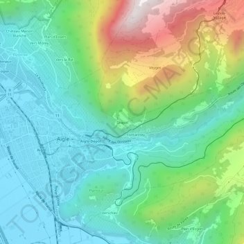
Name: Drapel topographic map, elevation, terrain.
Location: Drapel, Aigle, District d'Aigle, Vaud, 1860, Switzerland (46.30059 6.96294 46.34059 7.00294)
Average elevation: 2,349 ft
Minimum elevation: 1,263 ft
Maximum elevation: 5,075 ft
Thank you for supporting this site ❤️
Make a donation
Make a donation
Gear up for your next adventure:
As an Amazon Associate, this site earns from qualifying purchases at no extra cost to you.