
Thank you for supporting this site ❤️
Make a donation
Make a donation
Gear up for your next adventure:
As an Amazon Associate, this site earns from qualifying purchases at no extra cost to you.
Jumprava topographic map
Click on the map to display elevation.
Thank you for supporting this site ❤️
Make a donation
Make a donation
Gear up for your next adventure:
As an Amazon Associate, this site earns from qualifying purchases at no extra cost to you.
About this map
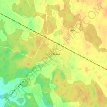
Name: Jumprava topographic map, elevation, terrain.
Location: Jumprava, Jumpravas pagasts, Ogres novads, LV-5022, Latvia (56.65562 24.94867 56.69562 24.98867)
Average elevation: 220 ft
Minimum elevation: 154 ft
Maximum elevation: 256 ft
Thank you for supporting this site ❤️
Make a donation
Make a donation
Gear up for your next adventure:
As an Amazon Associate, this site earns from qualifying purchases at no extra cost to you.