
Emmons topographic map
Click on the map to display elevation.
About this map
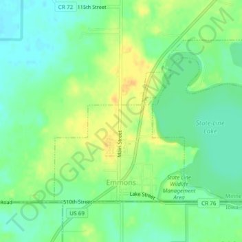
Name: Emmons topographic map, elevation, terrain.
Location: Emmons, Freeborn County, Minnesota, United States (43.49959 -93.49863 43.51771 -93.46842)
Average elevation: 1,273 ft
Minimum elevation: 1,230 ft
Maximum elevation: 1,329 ft
Freeborn County trails, hiking, mountain biking, running and outdoor activities
Other topographic maps
Click on a map to view its topography, its elevation and its terrain.
Albert Lea
United States > Minnesota > Freeborn County > Albert Lea > Albert Lea
Average elevation: 1,247 ft