Geolocate

Li Scalitti topographic map

Click on the map to display elevation.

About this map

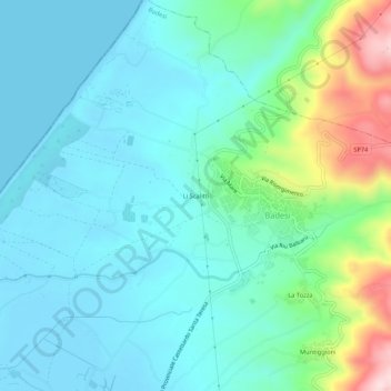
Name: Li Scalitti topographic map, elevation, terrain.

Location: Li Scalitti, Badesi, Sassari, Sardinia, 07030, Italy (40.94705 8.85314 40.98705 8.89314)

Average elevation: 233 ft

Minimum elevation: -3 ft

Maximum elevation: 1,109 ft

Gear up for your next adventure:

🧯Portable Fire Pit - Compact fire pit for camping spots
🪶Camping Sleeping Pad - Comfortable sleeping pad for backpacking
🌎3D Topographic Globes - Raised relief globes for a tactile understanding of geography
🔦LED Headlamp - Bright and durable LED headlamp for night navigation
🔥Camping Stove - Portable stove for camping and backcountry cooking

As an Amazon Associate, this site earns from qualifying purchases at no extra cost to you.