
Thank you for supporting this site ❤️
Make a donation
Make a donation
Gear up for your next adventure:
As an Amazon Associate, this site earns from qualifying purchases at no extra cost to you.
Espierba topographic map
Click on the map to display elevation.
Thank you for supporting this site ❤️
Make a donation
Make a donation
Gear up for your next adventure:
As an Amazon Associate, this site earns from qualifying purchases at no extra cost to you.
About this map
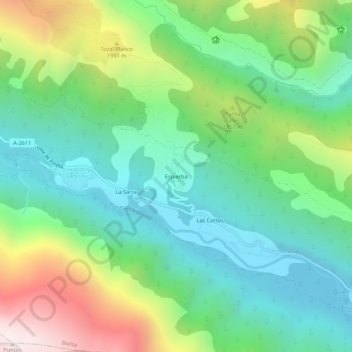
Name: Espierba topographic map, elevation, terrain.
Location: Espierba, Bielsa, Sobrarbe, Huesca, Aragón, España (42.63066 0.13613 42.67066 0.17613)
Average elevation: 5,289 ft
Minimum elevation: 3,786 ft
Maximum elevation: 8,533 ft
Thank you for supporting this site ❤️
Make a donation
Make a donation
Gear up for your next adventure:
As an Amazon Associate, this site earns from qualifying purchases at no extra cost to you.