
Thank you for supporting this site ❤️
Make a donation
Make a donation
Gear up for your next adventure:
As an Amazon Associate, this site earns from qualifying purchases at no extra cost to you.
Húsavík topographic map
Click on the map to display elevation.
Thank you for supporting this site ❤️
Make a donation
Make a donation
Gear up for your next adventure:
As an Amazon Associate, this site earns from qualifying purchases at no extra cost to you.
About this map
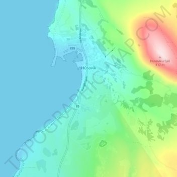
Name: Húsavík topographic map, elevation, terrain.
Location: Húsavík, Norðurþing, Norðurland eystra, 640, Island (66.01875 -17.37583 66.05848 -17.31777)
Average elevation: 276 ft
Minimum elevation: -3 ft
Maximum elevation: 1,335 ft
Thank you for supporting this site ❤️
Make a donation
Make a donation
Gear up for your next adventure:
As an Amazon Associate, this site earns from qualifying purchases at no extra cost to you.