

Grand Ballon topographic map
Click on the map to display elevation.
Grand Ballon
According to the Köppen climate classification, the top of the Grand Ballon features a subalpine climate (Köppen: Dfc) due to its high altitude comparable to the Alps or the Pyrenees. Along with the Hohneck the summit of the Grand Ballon is the coldest and windiest point in Alsace. A record low of −30.2 °C (−22.4 °F) was recorded on 10 February 1956, a record high of 29 °C (84 °F) was recorded on 13 August 2003. The temperature difference between the Grand Ballon and the neighboring plain (Mulhouse area) usually ranges from 7 to 10 °C (13 to 18 °F) and is higher in summertime. Winter snow cover is usually more than 1.5 m (5 ft) above 1,350 m (4,430 ft) of altitude. The highest snow accumulation ever recorded was 3.7 m (12 ft) on 7 March 2006; in 1969 and 1970 the snow cover was above 3 m (10 ft).
About this map
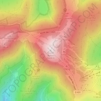
Name: Grand Ballon topographic map, elevation, terrain.
Average elevation: 3,737 ft
Minimum elevation: 2,385 ft
Maximum elevation: 4,656 ft