Geolocate

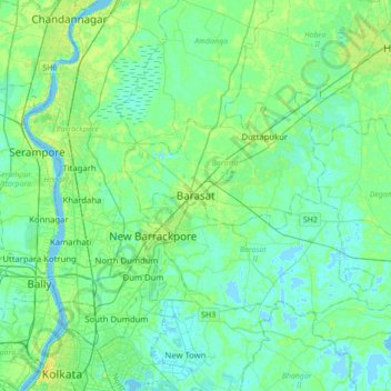
Barasat topographic map

Click on the map to display elevation.

Barasat

Its average elevation is 11 metres (36 ft). The nearest river is the Ganges, about 15 kilometres (9.3 mi) to the west, and it is on the Gangetic plain.

Wikipedia (CC-BY-SA 3.0)

About this map

Name: Barasat topographic map, elevation, terrain.

Location: Barasat, Kolkata Metropolitan Area, Barasat - I, North 24 Parganas, West Bengal, 700124, India (22.55911 88.32262 22.87911 88.64262)

Average elevation: 20 ft

Minimum elevation: -10 ft

Maximum elevation: 72 ft

Gear up for your next adventure:

🧦Merino Wool Socks - Moisture-wicking, blister-preventing socks for long treks
🧦Hiking Socks - Comfortable socks to prevent blisters on long hikes
🧺Microfiber Travel Towels - Compact and fast-drying towels for trail use
🔦Compact Flashlight - Reliable flashlight for emergencies
🔥Camping Stove - Portable stove for camping and backcountry cooking

As an Amazon Associate, this site earns from qualifying purchases at no extra cost to you.