Geolocate

General Island topographic map

Click on the map to display elevation.

About this map

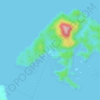
Name: General Island topographic map, elevation, terrain.

Location: General Island, Surigao del Sur, Caraga, Philippines (9.40197 125.99129 9.43004 126.02567)

Average elevation: 52 ft

Minimum elevation: -7 ft

Maximum elevation: 653 ft

Gear up for your next adventure:

🏫Relief Map Kits - Hands-on tools for teaching landforms and elevation
📱Solar Portable Charger - Solar power bank for charging devices off‑grid
🪶Wildlife Field Guides - Learn animal tracking and species ID
🏥Hiking First Aid Kits - Comprehensive medical kits for remote trail injuries
📌Outdoor GPS Map App - Apps and devices for digital topographic navigation

As an Amazon Associate, this site earns from qualifying purchases at no extra cost to you.