
Thank you for supporting this site ❤️
Make a donation
Make a donation
Gear up for your next adventure:
As an Amazon Associate, this site earns from qualifying purchases at no extra cost to you.
Caldelas topographic map
Click on the map to display elevation.
Thank you for supporting this site ❤️
Make a donation
Make a donation
Gear up for your next adventure:
As an Amazon Associate, this site earns from qualifying purchases at no extra cost to you.
About this map
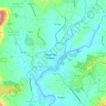
Name: Caldelas topographic map, elevation, terrain.
Location: Caldelas, Guimarães, Braga, 4805-133, Portugal (41.46812 -8.36264 41.50812 -8.32264)
Average elevation: 469 ft
Minimum elevation: 344 ft
Maximum elevation: 948 ft
Thank you for supporting this site ❤️
Make a donation
Make a donation
Gear up for your next adventure:
As an Amazon Associate, this site earns from qualifying purchases at no extra cost to you.