
Make a donation
Gear up for your next adventure:
As an Amazon Associate, this site earns from qualifying purchases at no extra cost to you.
Cheonjanggul (Cave) topographic map
Click on the map to display elevation.
Make a donation
Gear up for your next adventure:
As an Amazon Associate, this site earns from qualifying purchases at no extra cost to you.
About this map
Name: Cheonjanggul (Cave) topographic map, elevation, terrain.
Average elevation: 0 ft
Minimum elevation: 0 ft
Maximum elevation: 315 ft
Make a donation
Gear up for your next adventure:
As an Amazon Associate, this site earns from qualifying purchases at no extra cost to you.
Other topographic maps
Click on a map to view its topography, its elevation and its terrain.
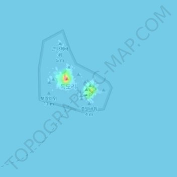
Dokdo Island
South Korea > Ulleung-gun > Dokdo-ri
The Liancourt Rocks, also known by their Korean name of Dokdo or their Japanese name of Takeshima, are a group of islets in the Sea of Japan between the Korean peninsula and the Japanese archipelago administered by South Korea. The Liancourt Rocks comprise two main islets and 35 smaller rocks; the total…
Average elevation: 0 ft