
Thank you for supporting this site ❤️
Make a donation
Make a donation
Gear up for your next adventure:
As an Amazon Associate, this site earns from qualifying purchases at no extra cost to you.
Brotdorf topographic map
Click on the map to display elevation.
Thank you for supporting this site ❤️
Make a donation
Make a donation
Gear up for your next adventure:
As an Amazon Associate, this site earns from qualifying purchases at no extra cost to you.
About this map
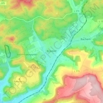
Name: Brotdorf topographic map, elevation, terrain.
Location: Brotdorf, Merzig, Landkreis Merzig-Wadern, Saarland, Deutschland (49.44619 6.64709 49.49867 6.69622)
Average elevation: 906 ft
Minimum elevation: 577 ft
Maximum elevation: 1,394 ft
Thank you for supporting this site ❤️
Make a donation
Make a donation
Gear up for your next adventure:
As an Amazon Associate, this site earns from qualifying purchases at no extra cost to you.