Geolocate

Owerri topographic map

Click on the map to display elevation.

About this map

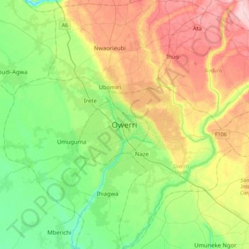
Name: Owerri topographic map, elevation, terrain.

Location: Owerri, Owerri Municipal, Imo State, 460281, Nigeria (5.32974 6.87420 5.64974 7.19420)

Average elevation: 289 ft

Minimum elevation: 75 ft

Maximum elevation: 633 ft

Gear up for your next adventure:

🔦Compact Flashlight - Reliable flashlight for emergencies
🦟Ultrasonic Repellers - Create a bug-free zone at your camp or rest stop
🔌USB Car Charger - Car charger for on‑the‑go power needs
🗺️Topographic Maps - Detailed topo maps for hiking, exploring and outdoor navigation
🪄Magnetic Compass - Accurate compass for navigation

As an Amazon Associate, this site earns from qualifying purchases at no extra cost to you.