Geolocate

Ocean City topographic map

Click on the map to display elevation.

About this map

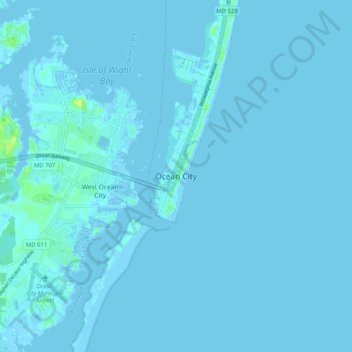
Name: Ocean City topographic map, elevation, terrain.

Location: Ocean City, Worcester County, Maryland, 21843, United States (38.29487 -75.12477 38.37487 -75.04477)

Average elevation: 3 ft

Minimum elevation: -20 ft

Maximum elevation: 49 ft

Maryland trails, hiking, mountain biking, running and outdoor activities

Gear up for your next adventure:

🪶Compact Camp Shovel - Folding shovel for campsite tasks
📶Satellite Messenger - Communication device off‑grid
🥤Water Filter Bottle - All‑in‑one filter bottle for safe hydration
🗺️Topographic Maps - Detailed topo maps for hiking, exploring and outdoor navigation
🦟Ultrasonic Repellers - Create a bug-free zone at your camp or rest stop

As an Amazon Associate, this site earns from qualifying purchases at no extra cost to you.