
Thank you for supporting this site ❤️
Make a donation
Make a donation
Gear up for your next adventure:
As an Amazon Associate, this site earns from qualifying purchases at no extra cost to you.
Loën topographic map
Click on the map to display elevation.
Thank you for supporting this site ❤️
Make a donation
Make a donation
Gear up for your next adventure:
As an Amazon Associate, this site earns from qualifying purchases at no extra cost to you.
About this map
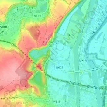
Name: Loën topographic map, elevation, terrain.
Location: Loën, Lixhe, Visé, Liège, Wallonie, 4600, Belgique (50.73764 5.64258 50.77764 5.68258)
Average elevation: 269 ft
Minimum elevation: 144 ft
Maximum elevation: 502 ft
Thank you for supporting this site ❤️
Make a donation
Make a donation
Gear up for your next adventure:
As an Amazon Associate, this site earns from qualifying purchases at no extra cost to you.