
Thank you for supporting this site ❤️
Make a donation
Make a donation
Gear up for your next adventure:
As an Amazon Associate, this site earns from qualifying purchases at no extra cost to you.
Kötschach-Mauthen topographic map
Click on the map to display elevation.
Thank you for supporting this site ❤️
Make a donation
Make a donation
Gear up for your next adventure:
As an Amazon Associate, this site earns from qualifying purchases at no extra cost to you.
About this map
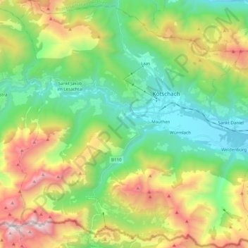
Name: Kötschach-Mauthen topographic map, elevation, terrain.
Location: Kötschach-Mauthen, Bezirk Hermagor, Carinthia, 9640, Austria (46.59530 12.88871 46.72868 13.07390)
Average elevation: 4,491 ft
Minimum elevation: 2,136 ft
Maximum elevation: 9,003 ft
Thank you for supporting this site ❤️
Make a donation
Make a donation
Gear up for your next adventure:
As an Amazon Associate, this site earns from qualifying purchases at no extra cost to you.