
Thank you for supporting this site ❤️
Make a donation
Make a donation
Gear up for your next adventure:
As an Amazon Associate, this site earns from qualifying purchases at no extra cost to you.
Humes topographic map
Click on the map to display elevation.
Thank you for supporting this site ❤️
Make a donation
Make a donation
Gear up for your next adventure:
As an Amazon Associate, this site earns from qualifying purchases at no extra cost to you.
About this map
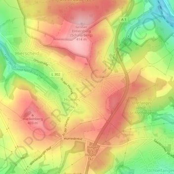
Name: Humes topographic map, elevation, terrain.
Location: Humes, Eppelborn, Landkreis Neunkirchen, Saarland, Deutschland (49.38407 6.97918 49.40039 7.02220)
Average elevation: 1,132 ft
Minimum elevation: 804 ft
Maximum elevation: 1,371 ft
Thank you for supporting this site ❤️
Make a donation
Make a donation
Gear up for your next adventure:
As an Amazon Associate, this site earns from qualifying purchases at no extra cost to you.