
Thank you for supporting this site ❤️
Make a donation
Make a donation
Gear up for your next adventure:
As an Amazon Associate, this site earns from qualifying purchases at no extra cost to you.
Soladüra topographic map
Click on the map to display elevation.
Thank you for supporting this site ❤️
Make a donation
Make a donation
Gear up for your next adventure:
As an Amazon Associate, this site earns from qualifying purchases at no extra cost to you.
About this map
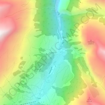
Name: Soladüra topographic map, elevation, terrain.
Location: Soladüra, Vals, Surselva, Grisons, 7132, Switzerland (46.60794 9.16305 46.64794 9.20305)
Average elevation: 5,925 ft
Minimum elevation: 3,737 ft
Maximum elevation: 8,737 ft
Thank you for supporting this site ❤️
Make a donation
Make a donation
Gear up for your next adventure:
As an Amazon Associate, this site earns from qualifying purchases at no extra cost to you.