Geolocate

San Roque topographic map

Click on the map to display elevation.

About this map

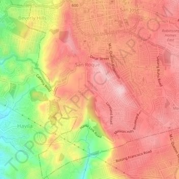
Name: San Roque topographic map, elevation, terrain.

Location: San Roque, Antipolo, Rizal, Calabarzon, 1870, Philippines (14.54915 121.15923 14.58791 121.18958)

Average elevation: 568 ft

Minimum elevation: 121 ft

Maximum elevation: 817 ft

Other topographic maps

Click on a map to view its topography, its elevation and its terrain.

Boso-boso River

Philippines > Rizal > Antipolo > San Joseph

Average elevation: 846 ft

Boso-boso River

Philippines > Rizal > Antipolo

Average elevation: 755 ft

Gear up for your next adventure:

🖼️Topo Map Wall Art - Decorative topographic prints of famous peaks and regions
🛡️Insect Repellent - Protection against bugs during outdoor activities
🛰️Satellite Messengers - Emergency SOS and two-way messaging for off-grid adventures
🪶Wildlife Field Guides - Learn animal tracking and species ID
🛶Inflatable Kayak - Portable kayak for rivers, lakes, and expeditions

As an Amazon Associate, this site earns from qualifying purchases at no extra cost to you.