Geolocate

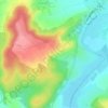
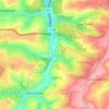
Berling topographic map

Click on the map to display elevation.

About this map

Name: Berling topographic map, elevation, terrain.

Location: Berling, Sarrebourg-Château-Salins, Moselle, Grand Est, Metropolitan France, 57370, France (48.78917 7.22421 48.81046 7.26091)

Average elevation: 892 ft

Minimum elevation: 705 ft

Maximum elevation: 1,033 ft

Other topographic maps

Click on a map to view its topography, its elevation and its terrain.
Everst Garten

France > Grand Est > Moselle > Villing > Trois Maisons

Average elevation: 938 ft

Saint-Pierremont

France > Grand Est > Moselle > Marsal

Average elevation: 745 ft

Grand Soldat

France > Grand Est > Moselle > Abreschviller

Average elevation: 1,391 ft

Metzing

France > Grand Est > Moselle > Riche

Average elevation: 774 ft

Falkenstein Castle

France > Grand Est > Moselle > Philippsbourg

In 1981, the Vosges Club (club vosgien) in Strasbourg placed a marker at the castle summit showing the altitude and directions to nearby land features.

Average elevation: 883 ft
Eschwiller Mill

France > Grand Est > Moselle > Eschviller

Average elevation: 988 ft

Fourneau Neuf

France > Grand Est > Moselle > Mouterhouse

Average elevation: 925 ft

Kapellenhof

France > Grand Est > Moselle > Hottviller

Average elevation: 1,056 ft

Holbach

France > Grand Est > Moselle

Average elevation: 1,086 ft

Mont Saint-Quentin

France > Grand Est > Moselle > Scy-Chazelles

Average elevation: 778 ft

Singling

France > Grand Est > Moselle

Average elevation: 1,070 ft

Crème

France > Grand Est > Moselle > Obreck

Average elevation: 748 ft

Hautes Phrases

France > Grand Est > Moselle > Château-Salins

Average elevation: 797 ft

Mont Saint-Quentin

France > Grand Est > Moselle > Scy-Chazelles

Average elevation: 778 ft

Moor

France > Grand Est > Moselle > Loudrefing

Average elevation: 791 ft

Audviller

France > Grand Est > Moselle > Wentzviller

Average elevation: 748 ft

Gear up for your next adventure:

🗺️NatGeo Topo Maps - High-quality waterproof printed topographic maps of US Parks
🧥Waterproof Jacket for Hiking - Breathable and rugged rain jacket for outdoor excursions
🧣Merino Neck Gaiters - Multi-functional headwear for wind and sun protection
🛌Ultralight Sleeping Bags - Compact down bags for cold nights in the wilderness
🌧️Backpack Rain Cover - Keep gear dry in wet weather

As an Amazon Associate, this site earns from qualifying purchases at no extra cost to you.