Geolocate

Kasar Devi topographic map

Click on the map to display elevation.

About this map

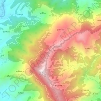
Name: Kasar Devi topographic map, elevation, terrain.

Location: Kasar Devi, Almora, Uttarakhand, 263636, India (29.63087 79.64492 29.67087 79.68492)

Average elevation: 5,075 ft

Minimum elevation: 3,839 ft

Maximum elevation: 6,381 ft

Gear up for your next adventure:

🚪Portable Camp Chair - Foldable chair for comfort at camp
🎒Trekking Poles - Sturdy poles for balance and stability on rough terrain
🪶Compact Camp Shovel - Folding shovel for campsite tasks
🏥Hiking First Aid Kits - Comprehensive medical kits for remote trail injuries
🧭Map Reading Tools - Tools and kits for map navigation

As an Amazon Associate, this site earns from qualifying purchases at no extra cost to you.