
Thank you for supporting this site ❤️
Make a donation
Make a donation
Gear up for your next adventure:
As an Amazon Associate, this site earns from qualifying purchases at no extra cost to you.
Kamonyi topographic map
Click on the map to display elevation.
Thank you for supporting this site ❤️
Make a donation
Make a donation
Gear up for your next adventure:
As an Amazon Associate, this site earns from qualifying purchases at no extra cost to you.
About this map
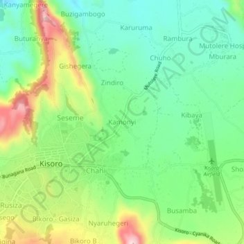
Name: Kamonyi topographic map, elevation, terrain.
Location: Kamonyi, Cyanika, Kisoro, Western Region, PO BOX 22, Uganda (-1.29536 29.68434 -1.25536 29.72434)
Average elevation: 6,227 ft
Minimum elevation: 5,876 ft
Maximum elevation: 6,880 ft
Thank you for supporting this site ❤️
Make a donation
Make a donation
Gear up for your next adventure:
As an Amazon Associate, this site earns from qualifying purchases at no extra cost to you.