Geolocate

Autheuil topographic map

Interactive map

Click on the map to display elevation.

About this map

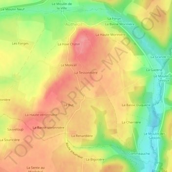
Name: Autheuil topographic map, elevation, terrain.

Location: Autheuil, Tourouvre au Perche, Mortagne-au-Perche, Orne, Normandie, France métropolitaine, 61190, France (48.54885 0.64891 48.57554 0.69339)

Average elevation: 728 ft

Minimum elevation: 558 ft

Maximum elevation: 853 ft

Other topographic maps

Click on a map to view its topography, its elevation and its terrain.

Tourouvre

France > Normandie > Orne > Tourouvre au Perche

Average elevation: 823 ft

Belle Perche

France > Normandie > Orne > Tourouvre au Perche

Average elevation: 873 ft

L'Etre Châtel

France > Normandie > Orne > Tourouvre au Perche

Average elevation: 738 ft

La Planche

France > Normandie > Orne > Tourouvre au Perche > La Planche

Average elevation: 741 ft