
Thank you for supporting this site ❤️
Make a donation
Make a donation
Gear up for your next adventure:
As an Amazon Associate, this site earns from qualifying purchases at no extra cost to you.
Bergua topographic map
Click on the map to display elevation.
Thank you for supporting this site ❤️
Make a donation
Make a donation
Gear up for your next adventure:
As an Amazon Associate, this site earns from qualifying purchases at no extra cost to you.
About this map
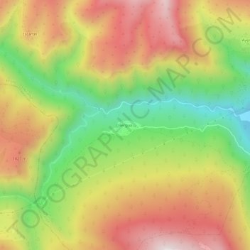
Name: Bergua topographic map, elevation, terrain.
Location: Bergua, Broto, Sobrarbe, Huesca, Aragón, 22372, España (42.51427 -0.19010 42.55427 -0.15010)
Average elevation: 4,042 ft
Minimum elevation: 2,671 ft
Maximum elevation: 5,341 ft
Thank you for supporting this site ❤️
Make a donation
Make a donation
Gear up for your next adventure:
As an Amazon Associate, this site earns from qualifying purchases at no extra cost to you.