
Starke topographic map
Click on the map to display elevation.
About this map
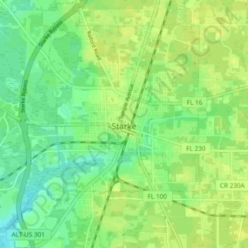
Name: Starke topographic map, elevation, terrain.
Location: Starke, Bradford County, Florida, 32091, United States (29.91600 -82.15081 29.97359 -82.08974)
Average elevation: 164 ft
Minimum elevation: 135 ft
Maximum elevation: 180 ft
Bradford County trails, hiking, mountain biking, running and outdoor activities
Other topographic maps
Click on a map to view its topography, its elevation and its terrain.