
Thank you for supporting this site ❤️
Make a donation
Make a donation
Gear up for your next adventure:
As an Amazon Associate, this site earns from qualifying purchases at no extra cost to you.
Neelum topographic map
Click on the map to display elevation.
Thank you for supporting this site ❤️
Make a donation
Make a donation
Gear up for your next adventure:
As an Amazon Associate, this site earns from qualifying purchases at no extra cost to you.
About this map
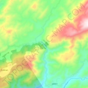
Name: Neelum topographic map, elevation, terrain.
Location: Neelum, Jabbri, Khyber Pakhtunkhwa, Pakistan (33.90117 73.15691 33.96791 73.17646)
Average elevation: 3,812 ft
Minimum elevation: 2,657 ft
Maximum elevation: 5,673 ft
Thank you for supporting this site ❤️
Make a donation
Make a donation
Gear up for your next adventure:
As an Amazon Associate, this site earns from qualifying purchases at no extra cost to you.