
Thank you for supporting this site ❤️
Make a donation
Make a donation
Gear up for your next adventure:
As an Amazon Associate, this site earns from qualifying purchases at no extra cost to you.
Boiro topographic map
Click on the map to display elevation.
Thank you for supporting this site ❤️
Make a donation
Make a donation
Gear up for your next adventure:
As an Amazon Associate, this site earns from qualifying purchases at no extra cost to you.
About this map
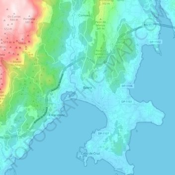
Name: Boiro topographic map, elevation, terrain.
Location: Boiro, A Barbanza, A Coruña, Galicia, 15930, Spain (42.60629 -8.92587 42.68629 -8.84587)
Average elevation: 289 ft
Minimum elevation: -3 ft
Maximum elevation: 1,923 ft
Thank you for supporting this site ❤️
Make a donation
Make a donation
Gear up for your next adventure:
As an Amazon Associate, this site earns from qualifying purchases at no extra cost to you.