Geolocate

Abranches topographic map

Click on the map to display elevation.

About this map

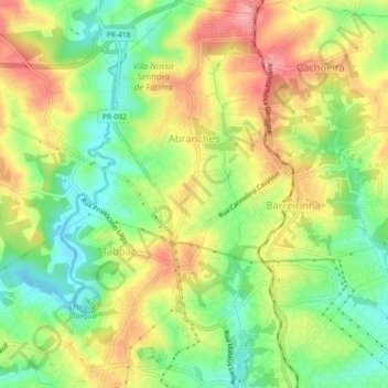
Name: Abranches topographic map, elevation, terrain.

Location: Abranches, Curitiba, Região Geográfica Imediata de Curitiba, Região Metropolitana de Curitiba, Região Geográfica Intermediária de Curitiba, Paraná, Região Sul, Brasil (-25.38781 -49.28138 -25.34692 -49.26657)

Average elevation: 3,146 ft

Minimum elevation: 2,979 ft

Maximum elevation: 3,330 ft

Other topographic maps

Click on a map to view its topography, its elevation and its terrain.

Gear up for your next adventure:

⛑️Personal Locator Beacon - Safety beacon for emergencies
🛡️Bear Spray Outdoor - Protection in bear country hikes
🥾Women's Hiking Boots - Top-rated trail boots with ankle support and superior grip
🧴Hand Sanitizer - Keep hands clean while hiking
🪶Camp Gear Gift Set - Perfect gift bundle for outdoor fans

As an Amazon Associate, this site earns from qualifying purchases at no extra cost to you.