

Lake Blue Ridge topographic map
Click on the map to display elevation.
Lake Blue Ridge
As part of the Blue Ridge Dam Rehabilitation project, the Tennessee Valley Authority, began slowly lowering the elevation of Blue Ridge Lake in July 2010. This rehabilitation project aimed to repair the dam penstock and to stabilize both the upstream and downstream faces of the dam. The project reduced the water level in the lake to approximately 1630 feet above sea level around the middle of October 2010 and the portion of work requiring the drawdown was completed in April 2011 when refilling of the lake began. However, TVA decided to hold the lake level at 1,672 feet through the summer of 2012 due to unexpected ground movement experienced in March 2012.
About this map
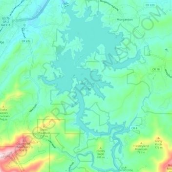
Name: Lake Blue Ridge topographic map, elevation, terrain.
Average elevation: 1,877 ft
Minimum elevation: 1,532 ft
Maximum elevation: 3,215 ft
Fannin County trails, hiking, mountain biking, running and outdoor activities