Geolocate

Sagaranten topographic map

Click on the map to display elevation.

About this map

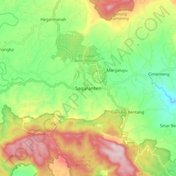
Name: Sagaranten topographic map, elevation, terrain.

Location: Sagaranten, Sukabumi, West Java, Java, 43181, Indonesia (-7.25900 106.84558 -7.17900 106.92558)

Average elevation: 1,398 ft

Minimum elevation: 738 ft

Maximum elevation: 2,297 ft

Gear up for your next adventure:

🏕️Family Camping Gear - Essentials for group camping trips
🧤Hiking Gloves - Protective gloves for rugged trails
🧭Pro Hiking Compasses - High-accuracy liquid-filled compasses for topographic orientation
🧣Merino Neck Gaiters - Multi-functional headwear for wind and sun protection
🪶Survival Guide Book - Expert advice for emergency preparedness

As an Amazon Associate, this site earns from qualifying purchases at no extra cost to you.