
Vrijbroekpark topographic map
Interactive map
Click on the map to display elevation.
About this map
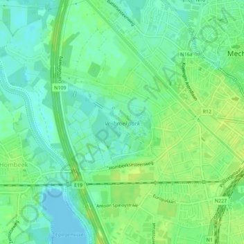
Name: Vrijbroekpark topographic map, elevation, terrain.
Location: Vrijbroekpark, Mechelen, Antwerpen, 2800, België (51.01592 4.44852 51.02518 4.46578)
Average elevation: 26 ft
Minimum elevation: -7 ft
Maximum elevation: 46 ft
Other topographic maps
Click on a map to view its topography, its elevation and its terrain.