Geolocate

Garfield topographic map

Click on the map to display elevation.

About this map

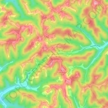
Name: Garfield topographic map, elevation, terrain.

Location: Garfield, Jackson County, West Virginia, United States (38.93480 -81.56457 38.97480 -81.52457)

Average elevation: 938 ft

Minimum elevation: 682 ft

Maximum elevation: 1,148 ft

Jackson County trails, hiking, mountain biking, running and outdoor activities

Other topographic maps

Click on a map to view its topography, its elevation and its terrain.

Ripley

United States > West Virginia > Jackson County

Average elevation: 705 ft

Gear up for your next adventure:

🌲Outdoor Survival Books - Best books on survival skills
👖Convertible Hiking Pants - Versatile zip-off pants for changing altitudes and temperatures
😴Insulated Sleeping Pads - Compact and warm pads for high-elevation camping
🛰️Handheld GPS Units - Professional satellite navigators for precise backcountry mapping
🧦Merino Wool Socks - Moisture-wicking, blister-preventing socks for long treks

As an Amazon Associate, this site earns from qualifying purchases at no extra cost to you.