Geolocate

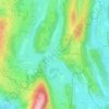
Saint-Julien topographic map

Click on the map to display elevation.

About this map

Name: Saint-Julien topographic map, elevation, terrain.

Location: Saint-Julien, Val-Suran, Lons-le-Saunier, Jura, Bourgogne-Franche-Comté, France métropolitaine, 39320, France (46.36712 5.43535 46.42350 5.47910)

Average elevation: 1,407 ft

Minimum elevation: 1,115 ft

Maximum elevation: 2,178 ft

Other topographic maps

Click on a map to view its topography, its elevation and its terrain.
La Chapelle

France > Bourgogne-Franche-Comté > Jura > Val-Suran > Saint-Julien

Average elevation: 1,355 ft
Saint-Julien

France > Bourgogne-Franche-Comté > Jura > Val-Suran

Average elevation: 1,355 ft

Bourcia

France > Bourgogne-Franche-Comté > Jura > Val-Suran

Average elevation: 1,342 ft

Gear up for your next adventure:

🌎3D Topographic Globes - Raised relief globes for a tactile understanding of geography
🧯Emergency Survival Kit - All‑in‑one survival essentials for the backcountry
🧷Carabiner Set - Durable clips for gear attachment
👖Convertible Hiking Pants - Versatile zip-off pants for changing altitudes and temperatures
😴Insulated Sleeping Pads - Compact and warm pads for high-elevation camping

As an Amazon Associate, this site earns from qualifying purchases at no extra cost to you.