
Barrington topographic map
Click on the map to display elevation.
Barrington
Barrington lies on a low, mostly flat plain bordering the sea. This plain, composed mostly of layers of clay, gravel, sand, and silt soils, was formed by a melting glacier towards the end of the last ice age. Bedrock underlying the soil is largely composed of shales, sandstone, and conglomerate rock, with some outcrops of quartz. A few extremes in elevation, such as Nayatt Point, Primrose and Prince's Hill, rise to heights of fifty feet.
About this map
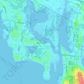
Name: Barrington topographic map, elevation, terrain.
Average elevation: 13 ft
Minimum elevation: -23 ft
Maximum elevation: 154 ft
Bristol County trails, hiking, mountain biking, running and outdoor activities
Other topographic maps
Click on a map to view its topography, its elevation and its terrain.
Touisset Wildlife Refuge
United States > Rhode Island > Bristol County > Warren
Average elevation: 20 ft