Geolocate

Kopachivka Rural Hromada topographic map

Click on the map to display elevation.

About this map

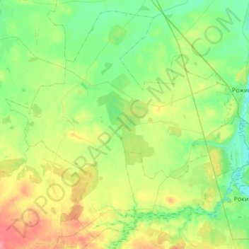
Name: Kopachivka Rural Hromada topographic map, elevation, terrain.

Location: Kopachivka Rural Hromada, Lutsk Raion, Volyn Oblast, Ukraine (50.80262 24.98137 50.97690 25.28349)

Average elevation: 636 ft

Minimum elevation: 564 ft

Maximum elevation: 768 ft

Other topographic maps

Click on a map to view its topography, its elevation and its terrain.

Solovychi

Ukraine > Volyn Oblast

Average elevation: 600 ft

Hruziatyn

Ukraine > Volyn Oblast

Average elevation: 574 ft

Pidkormillia

Ukraine > Volyn Oblast

Average elevation: 472 ft

Ozertsi

Ukraine > Volyn Oblast

Average elevation: 774 ft

Lavriv

Ukraine > Volyn Oblast > Lavriv

Average elevation: 702 ft

Gear up for your next adventure:

📡GPS Antenna Upgrade - Enhance GPS reception in remote terrain
🚪Portable Camp Chair - Foldable chair for comfort at camp
🪶Survival Guide Book - Expert advice for emergency preparedness
🧤Hiking Gloves - Protective gloves for rugged trails
🧦Hiking Socks - Comfortable socks to prevent blisters on long hikes

As an Amazon Associate, this site earns from qualifying purchases at no extra cost to you.