
Thank you for supporting this site ❤️
Make a donation
Make a donation
Gear up for your next adventure:
As an Amazon Associate, this site earns from qualifying purchases at no extra cost to you.
Hinojales topographic map
Click on the map to display elevation.
Thank you for supporting this site ❤️
Make a donation
Make a donation
Gear up for your next adventure:
As an Amazon Associate, this site earns from qualifying purchases at no extra cost to you.
About this map
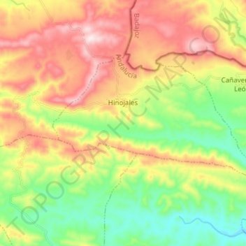
Name: Hinojales topographic map, elevation, terrain.
Location: Hinojales, Sierra de Huelva, Huelva, Andalusia, Spain (37.97204 -6.62341 38.02678 -6.50024)
Average elevation: 1,880 ft
Minimum elevation: 1,125 ft
Maximum elevation: 2,844 ft
Thank you for supporting this site ❤️
Make a donation
Make a donation
Gear up for your next adventure:
As an Amazon Associate, this site earns from qualifying purchases at no extra cost to you.